UIC research empowers communities in the face of climate change

Climate change is one of humanity’s most pressing emergencies and it is usually framed in global terms. But most of us encounter climate change on a more intimate scale — where we live and can see and feel changes in heat, flooding and severe weather.
Through the Community Research on Climate and Urban Science project, or CROCUS, University of Illinois Chicago researchers from several disciplines bring climate science down to the neighborhood level. In collaboration with Argonne National Laboratory and universities across the Midwest, UIC scientists and students deploy advanced sensors around the city, study the influence of trees and skyscrapers on Chicago’s climate and meet with communities to understand their most urgent problems and questions.
On the West and South sides of Chicago, researchers and partnering organizations are helping community members understand the local effects of climate change so they can design science-driven solutions. In Humboldt Park, researchers found measurable temperature differences between the east and west sides of the neighborhood, identifying priority areas for heat mitigation. And as the scale becomes more local, the focus expands to encompass areas such as public health, gentrification and housing policy.
“Science cannot remain isolated from the social problems of the world,” said Ralph Cintron, professor of English and Latin American and Latino studies at UIC. “It’s a catalyst that pulls all the disciplines together. It’s urban planning, economics and politics; it’s sociology and anthropology. Climate change is collapsing those barriers and forcing us to rethink what the relationships are.”
Measuring local impact with sensors and satellites
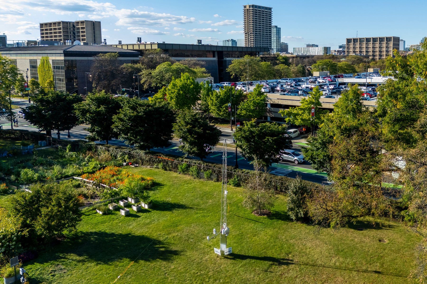
This summer, amidst the greenery of the UIC Plant Research Laboratory, a new project took root. A 30-foot tower near the greenhouse, studded with scientific instruments, now takes continuous measurements of temperature, wind and atmospheric conditions. One block away, the Dan Ryan Expressway hums with cars releasing carbon dioxide exhaust and particulates, while some of the nation’s tallest buildings loom above.
You couldn’t design a better location to study urban climate, where nature clashes with the manmade infrastructure of a large metropolis. And as the collaboration’s scientists deploy sensor nodes like this tower across Chicago, the data they collect will unlock deeper understanding about the complex factors at play in the city’s environment.

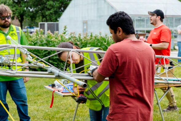
This July, the UIC node was the meeting point for the Urban Canyons campaign, which deployed dozens of student and faculty researchers from UIC, Argonne, University of Illinois Urbana-Champaign and other institutions along Roosevelt Road to take weather measurements over two 48-hour periods. Scientists will use data they collect to better understand the effect of skyscrapers on urban weather and build more accurate climate models for cities.
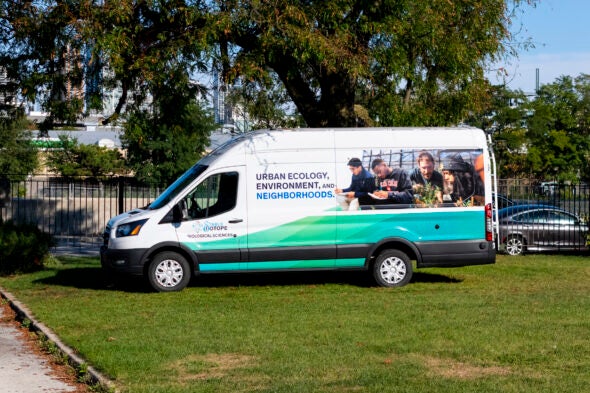
Starting this fall, UIC researchers will also be able to take these sophisticated sensors into Chicago’s neighborhoods with a new mobile science lab. The vehicle, like a television news van, has an extendable mast for taking aerial measurements from above the city’s streets and parks. In coming months, researchers will take the van to low-income or gentrifying areas such as Humboldt Park and North Lawndale, collecting data while also informing the public about the work they’re doing.
“The van has everything integrated in one place so we can measure things about the soil, the plants, the air, the environment, at different locations,” said Miquel Gonzalez-Meler, professor of biological sciences. “The mobile lab is also a way for us to bring environmental science to community members as opposed to asking them to come to us.”
A gradient of heat and wealth
In Humboldt Park, one such partnership has already led to published research and community climate response. A UIC research team led by postdoctoral researcher Jangho Lee used satellite temperature data to look at surface temperatures block by block across the Humboldt Park community area, the core of Chicago’s Puerto Rican community.
In recent decades, the east side of Humboldt Park has grown wealthier and whiter than its west side. UIC researchers found a ground surface temperature difference between the two: Sections of west Humboldt Park were as much as 2.7 degrees warmer on the hottest days than east Humboldt Park, less than 2 miles away.
“While this difference may seem negligible under moderate conditions, it can have serious implications during extreme heat events,” Lee said. “An increase in temperature under these conditions can lead to a sharp rise in heat-related mortality, particularly among the elderly, and also result in a significant increase in energy demand.”
A similar difference was seen across the entire city, where majority-Latino communities experienced higher surface temperatures than places where the population was predominantly white, Black or Asian. The reason became clear when combined with city data on vegetation, said Natalie Love, a former postdoctoral researcher at UIC and co-author of the study.
“Latino communities in Chicago have lower canopy cover and having less canopy cover has environmental consequences,” said Love, now a researcher at the Chicago Botanic Garden. “You can visualize pretty strongly the differences in canopy cover and how that translates to the differences in heat that people feel.”

The researchers presented these results to the community group Puerto Rican Agenda, highlighting the need for more affordable housing in cooler areas and the use of greenspace to mitigate heat. But researchers are also listening to resident concerns about environmental gentrification, including worry that green infrastructure improvements could have unintended consequences.
That’s where UIC experts on urban planning and economics can play a key role by making sure science translates to positive community impact, said Matthew Wilson, associate director of economic and workforce development at UIC’s Great Cities Institute.
“Part of the challenge when we think about things like planting street trees to address exposure to heat is, are we going to be creating a neighborhood that the people that are intended to benefit from this will be able to live in?” Wilson said. “Or are we going to accelerate a process of neighborhood change by making these blocks more desirable places to live which will in turn increase housing costs?”
The collaboration is also creating opportunities for education and participation beyond the UIC campus, including a curriculum on climate change for a Humboldt Park alternative high school, an app that allows community members to collect data from trees in their neighborhood and a summer exchange program for students to work on climate research in Puerto Rico. By making the challenges of climate change local, the collaboration hopes to recruit a broader, larger coalition of people to help fight it.
“The fact that we can involve people in research in their backyards and in their own neighborhoods, where they know they have these environmental issues and they know the people who live there, adds an extra value of connection that other scientific projects may not have,” Gonzalez-Meler said.
Inspiring new research, outreach and education
Greening projects may also help protect against another community concern: urban flooding, a growing problem as climate change increases the frequency of severe storms.
“One of the common threads among the community groups is managing flood risk,” said Max Berkelhammer, associate professor of earth and environmental sciences. “And one of the ways to manage flood risk is with green infrastructure — increasing trees and permeable surfaces.”
But whether the goal is protection from heat or flooding, not all plants are equally helpful. Ongoing research will identify which plants would best protect communities against heat or flooding or improve air quality without causing unintended harm to residents or ecosystems. The research will use the sensor node network and mobile lab, as well as sensors installed on trees — including several on the UIC campus — to monitor how much water they use and the exchange of oxygen and carbon dioxide through their leaves.

“We are trying to understand the traits that plants and trees have, to say which are good candidates for these properties and for these benefits and which are bad candidates for these uses,” said Ahram Cho, a postdoctoral researcher with the project. “For instance, some may be very good candidates for flood prevention, but they are bad candidates for allergy and for air quality.”
As the research expands, so do the opportunities for UIC students. Because studying climate change at the local level involves so many different approaches, the efforts attract students studying a variety of topics and from groups traditionally underrepresented in STEM fields.
“Students get the feeling of being part of something bigger, meeting researchers from other places and using equipment that they wouldn’t have access to otherwise,” Berkelhammer said. “And I think there’s just an excitement and enthusiasm about being part of this big, exciting effort, where you’re not just in one small lab working on one small problem.”
“UIC is really an important leader in changing the future of science: making it more interdisciplinary, bringing in populations which historically have been marginalized from scientific communities,” Cintron said. “We’re beginning to change, literally, the face of science.”
