Online tool measures access to jobs, schools, parks and more
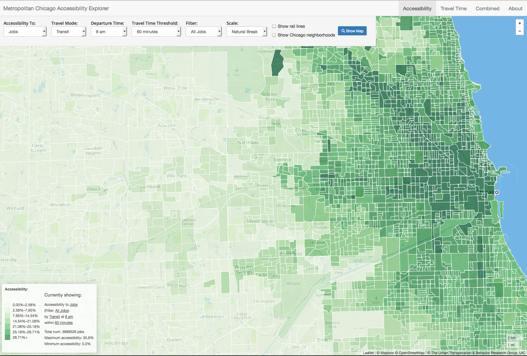
The Metropolitan Chicago Accessibility Explorer maps jobs in the nine-county area and other resources in Chicago. (Select image to download larger file size)
Urban planners and policymakers in an eight-county Chicago region have a new digital means to measure access to key resources by transit, car, bicycle or walking.
The Metropolitan Chicago Accessibility Explorer is a map-based tool developed by researchers in the Urban Transportation Center at the University of Illinois at Chicago. Planners can use it to identify areas that need greater access to jobs, schools, grocery stores, hospitals, parks, libraries and fire stations. The public can use it free of charge.
The data and visuals cover Cook, DuPage, Lake, Kendall, Will, McHenry, Kane and Grundy counties.
“We aim to provide a tool that planners can readily use to evaluate how well the transportation system is connecting people to activity locations,” said Nebiyou Tilahun, assistant professor of urban planning and policy, who developed the site. “It’s had hundreds of visits already from users, including some in Europe and South America.”
Drop-down options lead to visual displays of the number of jobs in specific industries, public and private schools, and other resources a resident can reach from a specified location, within a selected amount of time, using various modes of transportation. Job data can be refined by filters to indicate jobs held by persons of varying age, gender, race, ethnicity, education level and earnings.
A search for accessible schools can be refined by choosing public, private, or either. Access to parks can be measured by the number of parks or the area of parkland.
“Similar tools exist, but I haven’t seen anything this interactive, particularly focused on Chicago,” Tilahun said.
When the user selects a transportation option, search results indicate the number and percentage of the selected resource (jobs in the eight-county area, or other resources in Chicago only) that can be reached within the specified time from each location. To measure access from a location, the user waits for the map to load, then hovers the cursor over the location. A pop-up tells the number and percentage of accessible resources in the chosen category.
Each location is identified by its Census block group number — the smallest area for which the Census Bureau releases some types of data used in the Accessibility Explorer.
To develop the tool, Tilahun and a team of graduate students worked for more than a year to measure travel times for each mode; collect land-use data from federal, state, county and local governments and agencies; and integrate the data for easy interpretation. The data are the latest available from the Census Bureau and other federal and local agencies.
The project was funded by the Illinois Department of Transportation’s Metropolitan Transportation Support Initiative at UIC and the National Center for Transit Research.
The UIC Urban Transportation Center provides research, education and technical assistance on urban transportation planning, policy, operations and management. It is part of the UIC College of Urban Planning and Public Affairs, a nationally recognized innovator in education, research, and engagement in support of the nation’s cities and metropolitan areas.
